By Rob Case, Ph.D., P.E.
Suffolk has completed two significant segments of the Seaboard Coastline Trail, a 10’ wide paved multi-use trail that will run from downtown Suffolk to the Chesapeake city line using the former Seaboard Coastline Railroad right-of-way:
- the northern 3.5 mile segment—opened in 2015—runs from the village of Driver to the Pughsville neighborhood and Chesapeake city line near I-664
- the southern 1.5 mile segment—opened in 2021—runs from Suburban Drive to Nansemond Parkway near US 58 (Suffolk Bypass).
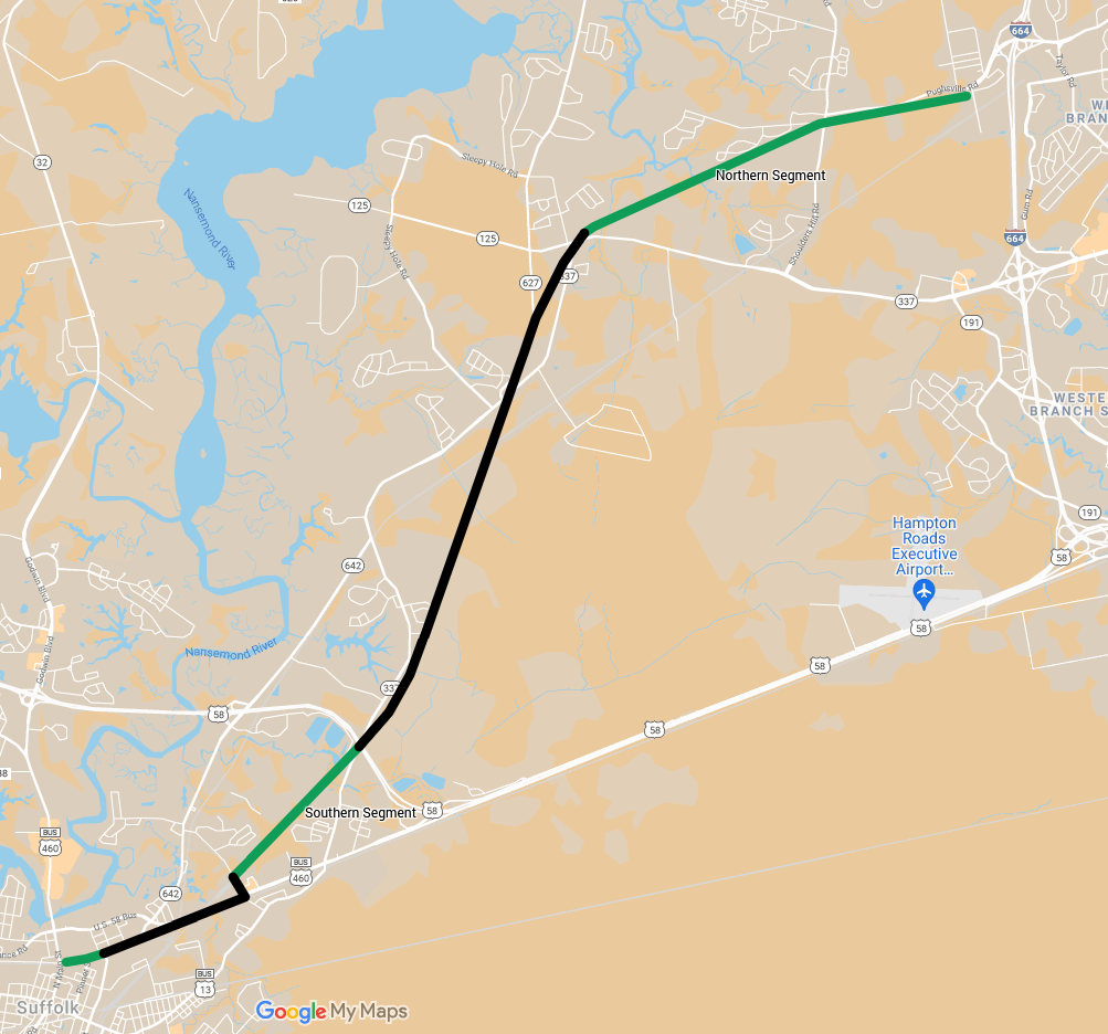
Seaboard Coastline Trail (planned-black line; existing-green)
Source: HRTPO via Google My Maps
(Note that the short green segment—shown in the downtown area above—runs from Suffolk Train Station to Moore Avenue, a distance of a few blocks.)
The existing Seaboard Coastline Trail segments shown above are the first completed segments of the South Hampton Roads Trail, which is part of a planned regional system of major trails shown below.
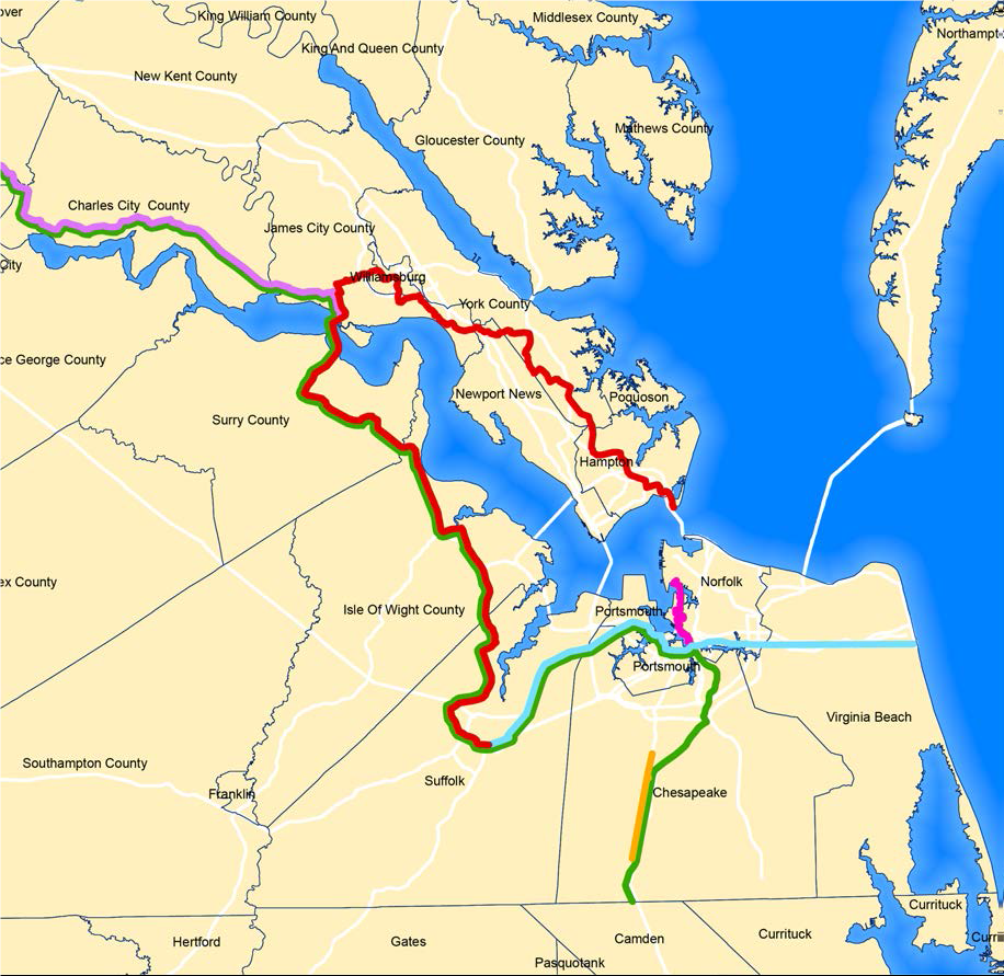
Major Active Transportation Routes
Source: Linking Hampton Roads, HRTPO, March 2020, pg. 25
The completed segments, being rail trails, serve both transportational (destination-driven) and recreational purposes, as discussed separately below.
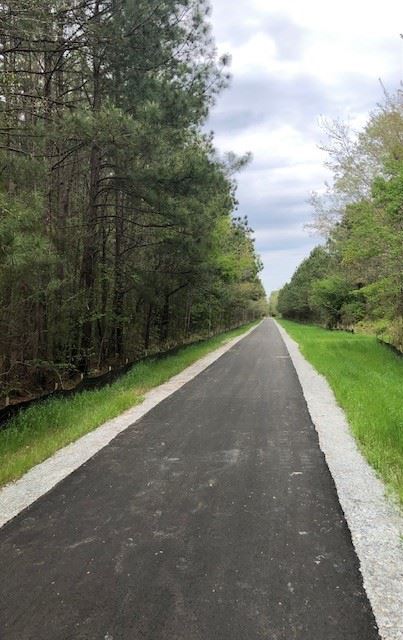
The recreational usage of the southern segment is enhanced by the trail’s pleasant design, its separation from roadway noise, and its environs, as shown below:

Creek Crossing the Seaboard Coastline Trail
Source: HRTPO staff
Cross Section of the Seaboard Coastline Trail
Source: HRTPO staff
The usage of the northern segment of the trail for transportation is enhanced by the village of Driver located at its western terminus.
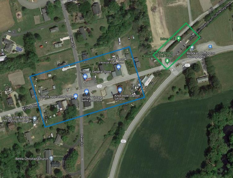
Destinations in Driver near the Seaboard Coastline Trail
Source: Google Maps
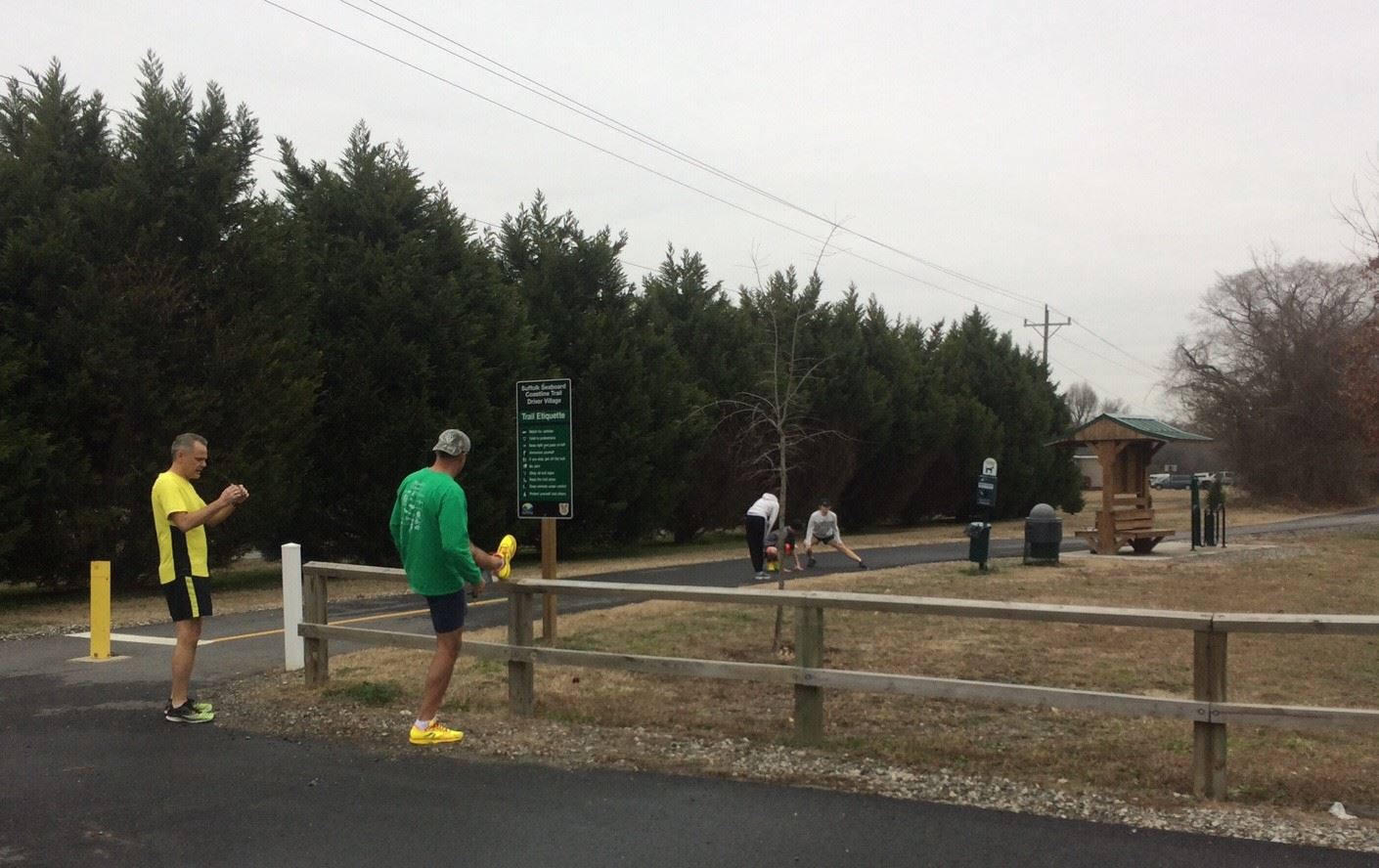
Using the Seaboard Coastline Trail
Source: HRTPO
For both recreation and transportation, the inhabitants of nearby residential neighborhoods can access the trail within a short distance of their homes, as shown below:
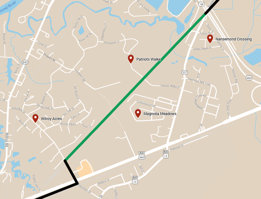
Neighborhoods along the Southern Segment of the Seaboard Coastline Trail
Source: HRTPO via Google My Maps
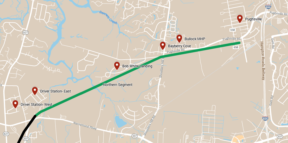
Neighborhoods along the Northern Segment of the Seaboard Coastline Trail
Source: HRTPO via Google My Maps
If you don’t live near the trail, you can access it by riding the bus or by parking your car in trailhead parking lots.
Three bus routes of Suffolk Transit https://www.suffolkva.us/429/Suffolk-Transit serve the southern segment of the trail:
- Red Route
- Pink Route
- Orange Route
Two routes serve the northern segment of the trail:
In addition, you can access the trail by auto using the following trailhead parking lots.
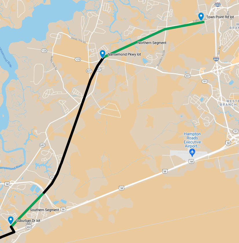
Parking Lots along the Seaboard Coastline Trail
Source: HRTPO via Google My Maps
The Suburban Drive lot (212 Suburban Drive) provides parking, a picnic table, and bike fix-it station.
See you on the trail!